Port Antonio Weather
MOBILE USERS: More info drag right →
Last updated: Sat Jul 5 20:25:25 2025
Latitude: 18.190217093288000 / Longitude: -76.449534866102620 - Google Map
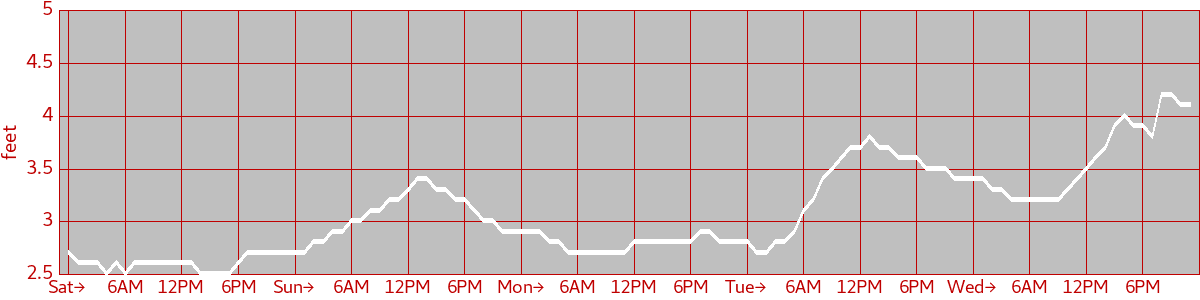
Wave Height
Wave Direction
| Sat→ 12:00 AM : E 09:00 PM : SE | Sun→ 12:00 AM : SE 11:00 AM : E | Mon→ 12:00 AM : E | Tue→ 12:00 AM : E | Wed→ 12:00 AM : E 08:00 PM : SE |
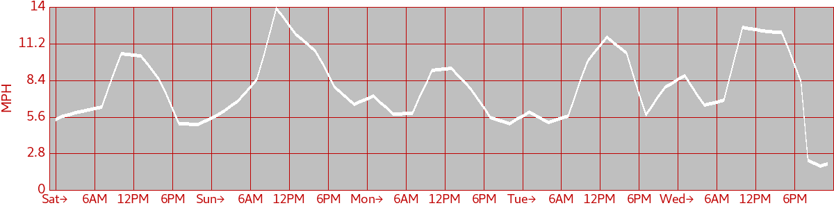
Wind Speed
Wind Direction
| Sat→ 12:00 AM : SE 08:00 AM : E 07:00 PM : SE 11:00 PM : E | Sun→ 12:00 AM : E 04:00 AM : SE 09:00 AM : E 07:00 PM : SE 10:00 PM : E | Mon→ 12:00 AM : E 07:00 PM : SE 10:00 PM : E | Tue→ 12:00 AM : E | Wed→ 12:00 AM : E 07:00 AM : SE 09:00 AM : E 11:00 PM : NE |
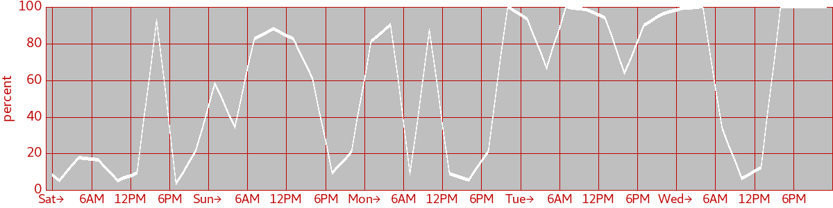
Cloud Cover
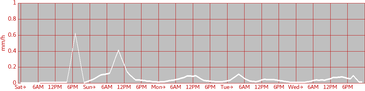
Precipitation
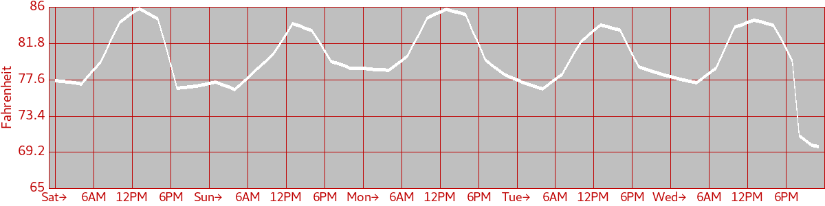
Air Temperature
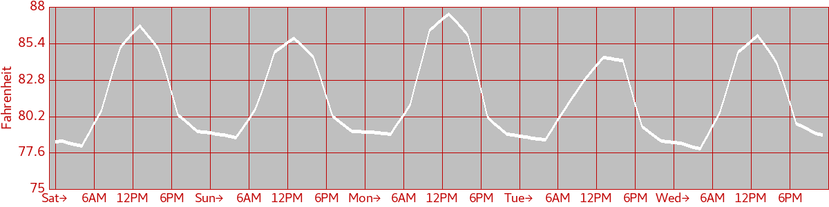
Water Temperature
Astronomy
| Sat Sunrise: 05:35 AM Sunset: 06:47 PM Moon lit: 72% | Sun Sunrise: 05:36 AM Sunset: 06:47 PM Moon lit: 80% | Mon Sunrise: 05:36 AM Sunset: 06:47 PM Moon lit: 87% | Tue Sunrise: 05:36 AM Sunset: 06:47 PM Moon lit: 93% | Wed Sunrise: 05:37 AM Sunset: 06:46 PM Moon lit: 97% |
Tide Table
| Sat 12:37 AM low 0.16m 04:31 AM high 0.19m 11:31 AM low 0.04m 06:59 PM high 0.28m | Sun 01:32 AM low 0.14m 05:22 AM high 0.18m 12:06 PM low 0.02m 07:33 PM high 0.29m | Mon 02:12 AM low 0.13m 06:09 AM high 0.17m 12:40 PM low 0.01m 08:03 PM high 0.30m | Tue 02:43 AM low 0.11m 06:53 AM high 0.17m 01:13 PM low -0.01m 08:32 PM high 0.32m | Wed 03:10 AM low 0.10m 07:35 AM high 0.18m 01:47 PM low -0.01m 09:02 PM high 0.33m |