Anclote Key Weather
MOBILE USERS: More info drag right →
Last updated: Thu May 8 23:30:49 2025
Latitude: 28.091939070427570 / Longitude: -82.815503329276740 - Google Map
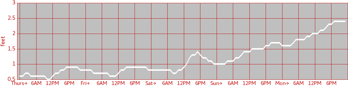
Wave Height
Wave Direction
| Thurs→ 12:00 AM : SW 07:00 AM : S 09:00 AM : SW | Fri→ 12:00 AM : SW 11:00 PM : W | Sat→ 12:00 AM : W 08:00 AM : SW 02:00 PM : S | Sun→ 12:00 AM : S 05:00 PM : SW | Mon→ 12:00 AM : SW 04:00 AM : S 08:00 PM : SW |
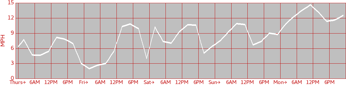
Wind Speed
Wind Direction
| Thurs→ 12:00 AM : SE 01:00 AM : NE 02:00 AM : E 06:00 AM : SE 09:00 AM : S 11:00 AM : SW 06:00 PM : W 08:00 PM : NW 09:00 PM : W 10:00 PM : SW 11:00 PM : S | Fri→ 12:00 AM : SW 02:00 AM : E 05:00 AM : SE 07:00 AM : S 08:00 AM : SW 06:00 PM : W 09:00 PM : NW 11:00 PM : N | Sat→ 12:00 AM : NE 02:00 AM : E 04:00 AM : SE 07:00 AM : E 09:00 AM : SE 12:00 PM : S 04:00 PM : SW 09:00 PM : S 10:00 PM : SE | Sun→ 12:00 AM : SE 02:00 AM : S 04:00 AM : SE 04:00 PM : S 06:00 PM : SE | Mon→ 12:00 AM : SE 04:00 PM : S 07:00 PM : SE 11:00 PM : S |
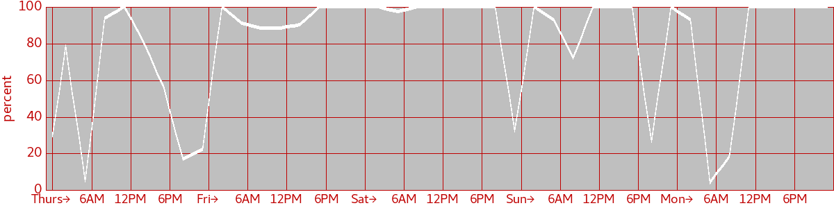
Cloud Cover
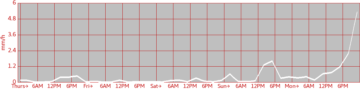
Precipitation
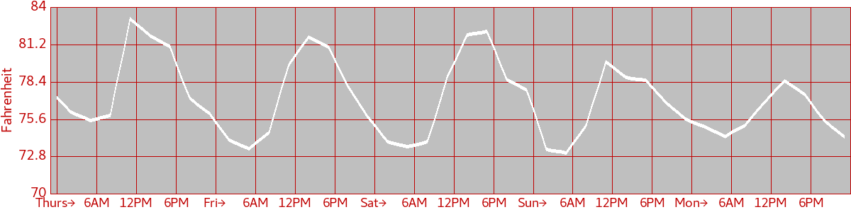
Air Temperature
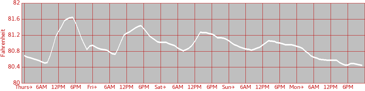
Water Temperature
Astronomy
| Thurs Sunrise: 06:47 AM Sunset: 08:11 PM Moon lit: 83% | Fri Sunrise: 06:46 AM Sunset: 08:11 PM Moon lit: 89% | Sat Sunrise: 06:45 AM Sunset: 08:12 PM Moon lit: 94% | Sun Sunrise: 06:45 AM Sunset: 08:12 PM Moon lit: 98% | Mon Sunrise: 06:44 AM Sunset: 08:13 PM Moon lit: 100% |
Tide Table
| Thurs 03:55 AM low 0.27m 10:24 AM high 0.89m 04:58 PM low 0.16m 11:13 PM high 0.70m | Fri 04:30 AM low 0.31m 10:45 AM high 0.95m 05:32 PM low 0.06m 11:52 PM high 0.71m | Sat 05:00 AM low 0.34m 11:07 AM high 1.01m 06:04 PM low -0.02m | Sun 12:28 AM high 0.72m 05:27 AM low 0.37m 11:30 AM high 1.05m 06:36 PM low -0.07m | Mon 01:03 AM high 0.72m 05:52 AM low 0.40m 11:55 AM high 1.08m 07:10 PM low -0.10m |